
|
 |
 |
 |
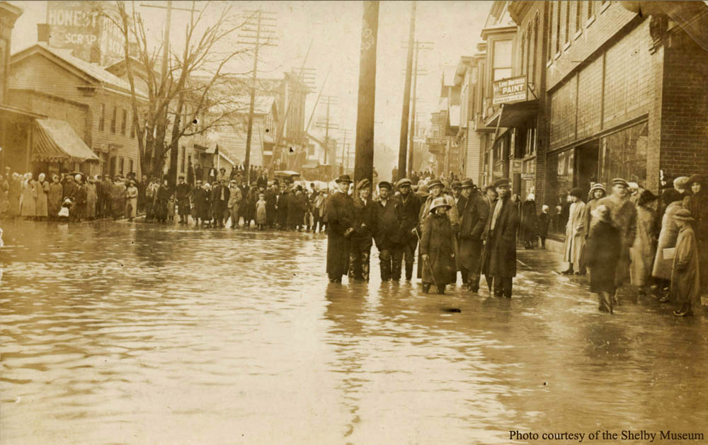
This is one of a series of photos taken on Saturday, March 25th, 1913 during the height of the flood in Shelby. This view is looking to the east from a point at the corner of East Main Street and High School Avenue. The "Paint" sign on the south side of the street was located at 42 East Main Street. The "LUNCH" sign further to the east across from the B & O R.R. was located at 62 East Main Street, the current location of Domino's Pizza, previously the Whitehouse Restaurant and in 1913, Frank Huber's Saloon and Restaurant. The B & O R.R. crossing gates (raised) can be seen above the on-lookers in the left upper center of the photo. Beyond the gates at 59-61 East Main Street is the J. C. Morris Elevator and further on at the northwest corner of Main and North Broadway, stands the Opera House. The buildings on the west side of the B & O tracks (on the north side of Main Street) are first, William Guerin's Saloon and Restaurant at 55 East Main and then the Kline & Myers Millinery Shop at 53 East Main. At 49 East Main is the millinery shop of Mrs. Simon Jay (Flossie Naomi) Dick.
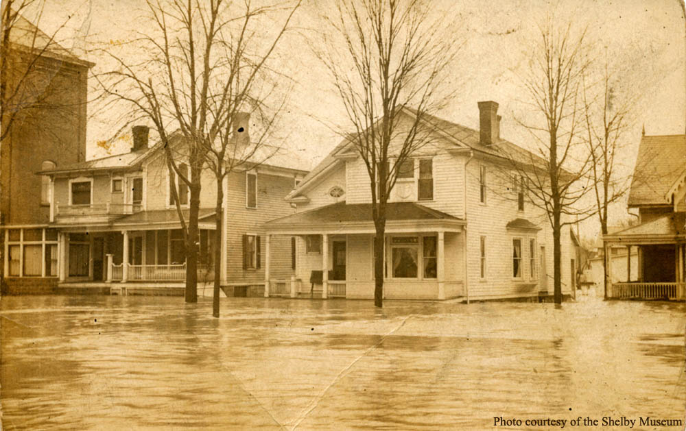
The photographer turned to the north and captured this view. These three homes are located on the north side of East Main Street across from Central Park. The home on the left (23 East Main Street) is that of John C. and Frances Roush Sutter. To the right is Frederick and Nellie Mickey Sutter's residence. At the extreme right is the home of Isabelle Spear Trimble, widow of John S. Trimble. At extreme left is the east side of the Masonic Temple.
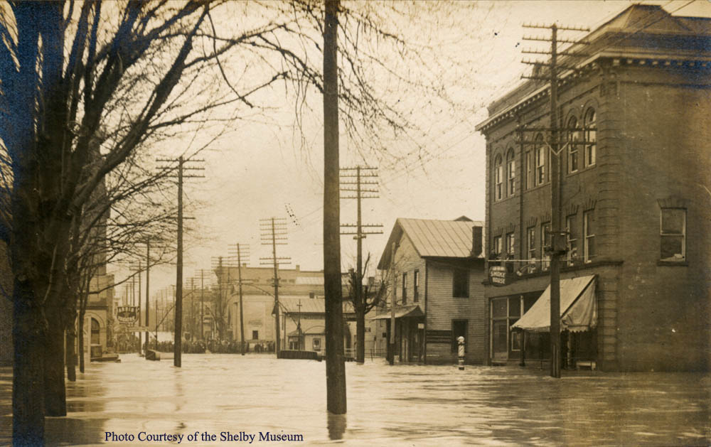 |
| The photographer turned to the west and took this view. On the right is the Masonic Temple with a sign advertising the Smoke House which was run by John R. Miller. The Temple structure also housed the Shelby Post Office (Plimpton S. Lybarger was the Postmaster.), the Colonial Club, and B. F. Long's Law Office. To the left, across Mohican Street at 13 East Main Street, was the American Express Office and the local Shelby, Norwalk, and Mansfield Interurban Ticket Office. |
 |
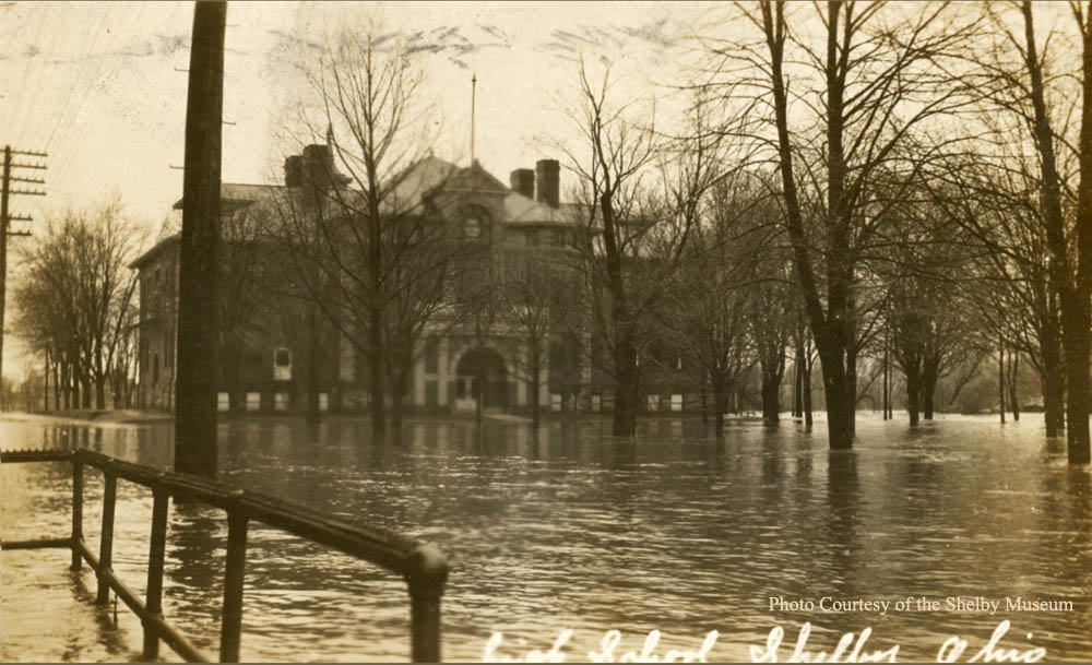 |
| The photographer then turned south and took this view of Central School built in 1901 situated on the west side of High School Avenue. Notice the chimneys on the left side of the building partly obscure the bell tower of the older Central School that was constructed in 1875. Both buildings served as both primary and high school during their lifetimes. They were both demolished when "new" Central School was built in 1950. |
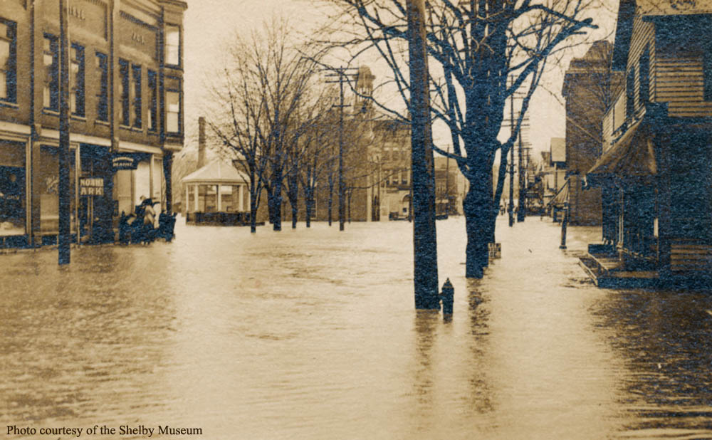 |
| This photo was taken from the north side of East Main Street looking west. On the left center is the Noah's Ark Store (38 East Main), the approximate location where the photographer stood to take the first four photos presented in this article. On the corner of High School Avenue (36 East Main) is the Kotz & Clark Shoe Store and just to the right is the new (1910) Central Park Band Stand. Further right is the Fire Station and across Main Street is the Masonic Temple and to the extreme right is the Stahl and DeWitt Bakery (41 East Main). |
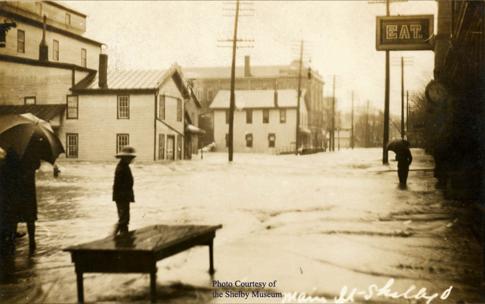 |
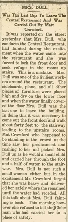
| This view is looking east on West Main Street, the photographer standing in front of the Kuhn Drug Store (26 West Main) owned and operated by George H. Kuhn (wife Elma Nothacker Kuhn). Directly to the east, the sign "EAT" on the front the European Hotel (24 West Main) advertises their "Central Restaurant". The hotel proprietor was Mrs. Edith Wert Dull, widow of Marlin M. Dull who died in 1912. Across the street some of the building of City Mills (17 West Main) can be seen. Beyond the Main Street bridge is the Felter Brothers Saloon (11 East Main) and the American Express and interurban ticket offices at 13 East Main. The Masonic Temple building located east of Mohican Street (19-21 East Main) can also be seen. |
 |
 |
| The photographer walked east a few steps from the location of the previous photo and recorded this view. The clock at the right signified the location of Oren L. Sharick's jewelry store at 22 West Main (on the west corner at Blackfork Street) which is currently occupied by Copperfast. The other buildings in the distance will be identified in the following photo. Note the water has not covered the entire Main Street bridge at this time. |
 |
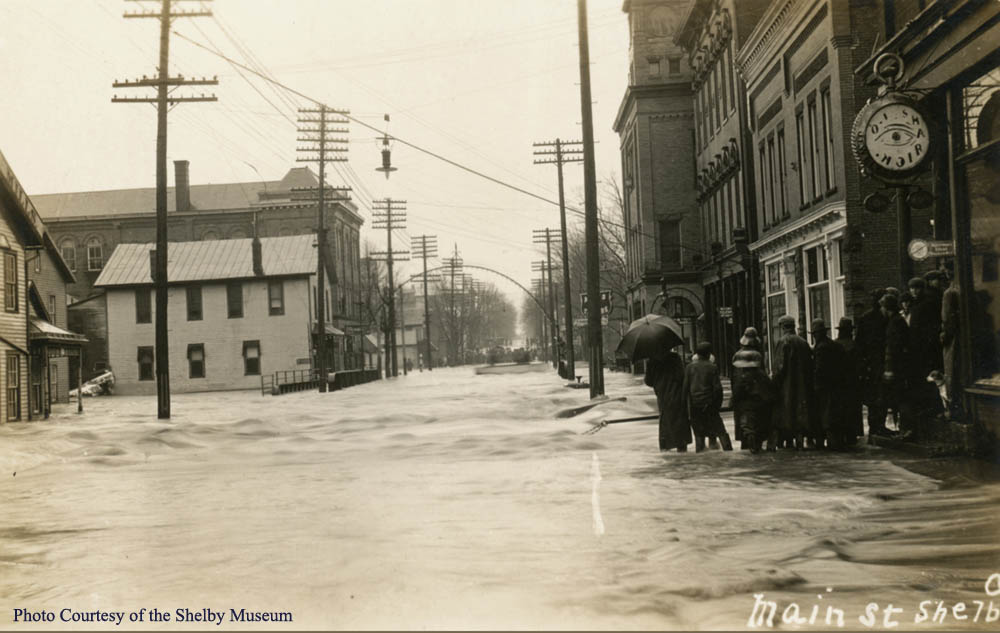
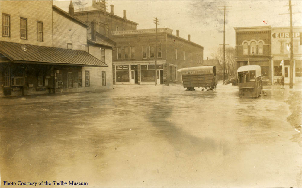
| This scene was viewed from the center of West Main Street looking east beyond the Main Street bridge which is now completely covered with water in the center of the photo. Note the group of on lookers gathered on East Main Street facing toward the camera. Perhaps many of them are the same as in the first photo. The first building to the right (20 West Main) was the home of Henry Wentz's growing Mutual Insurance Company. The Sutter Furniture Company office was located next to it at 18 West Main. Beyond them was City Hall (16 West Main) which housed the Sharon Township offices as well as the Western Union Telegraph Office and on the third floor was the I.O.O.F. In the same structure but listed as 14 West Main, was the Mayor's Office (George I. Miller was mayor at the time.) and City Hall. Further east on the street was the Garrett Building that housed at 12 West Main, the plumbing store of George Hutchinson on the first floor and Edwin B. Lybarger, optician, on the second, with the K.of P. Hall on the top floor. 12 West Main is the current home of Napoli's Pizza. The eastern portion of the building (10 West Main) held the Arris Theater. Across the Main Street bridge on the south side can be seen the firehouse (14 East Main) just beyong the Arris Theater sign. The building at the extreme right is part of City Mills (17 West Main) that was run by Roger Heath's sons (Roger died in 1911.). Across the bridge can be seen the building at 11 East Main that housed the Felter Brothers Saloon. |
 |
| This photo was taken from the north side of West Main Street giving a better perspective of some of the buildings described previously, from left to right: Firehouse (14 East Main), Main Street bridge, Garrett Building (10 - 12 West Main), City and Township Hall (14 - 16 West Main) and Sutter Furniture and Mutual Glass Insurance offices (18 - 20 West Main). Note the depth and velocity of water on Blackfork Street around the stranded horse drawn wagon. |
 |
 |
 |
| The photographer was standing on the west side of Washington Street facing south toward the Main and Blackfork Street intersection. This gives a frontal view of the Sutter Furniture and Mutual Plate Glass offices (18 - 20 West Main), the O.L. Sharick Jewelry Store (22 West Main) and the European Hotel at 24 West Main. Note the two additional abandoned horse drawn wagons across Washington Street from the City Mills structures at 17 West Main. |
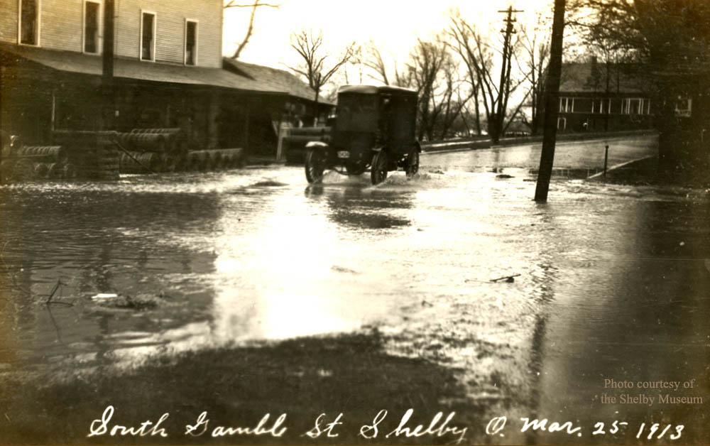 |
| The Tuby Run crossing of South Gamble Street is flooding over the "stone brdge" just north of the Frank A. Abbott Farm Implement and horse drawn - buggie store at 37 South Gamble. Note the home (upper right) of Roscoe and Rouie Stauffer Crall at 47 South Gamble. |
 |
|
 |
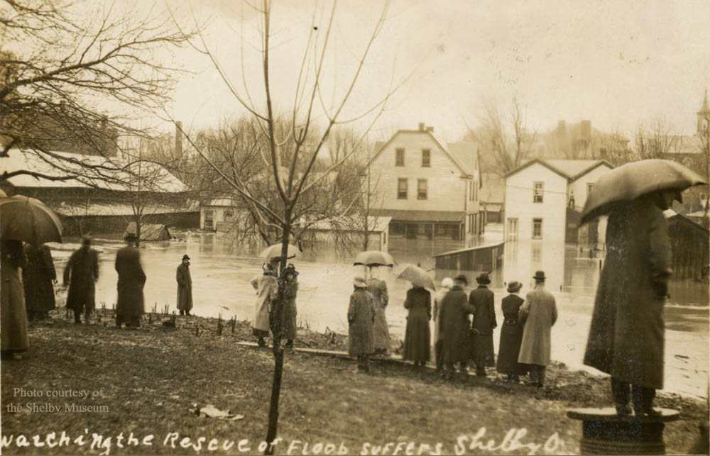
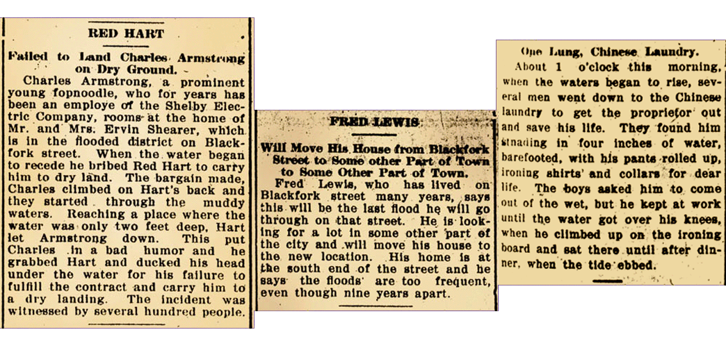
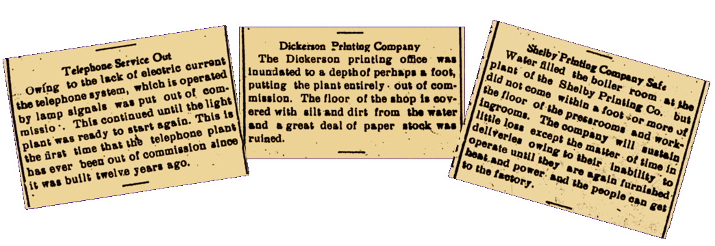
| This view is similar to the previous one but taken from a closer position. Debris and some water marks on buildings indicate the water has receded a bit. Note the bell tower of the 1875 Central School above the smaller of the dark buildings at mid-picture. To the left of the 1875 building can be seen the roof and chimneys of the "newer" (1901) Central School. The Fred Lewis family had lived at 28 Blackfork Street for more than 13 years. He was a well known contractor and building mover. The following articles appeared in the Daily Globe, on March 26, 1913. |
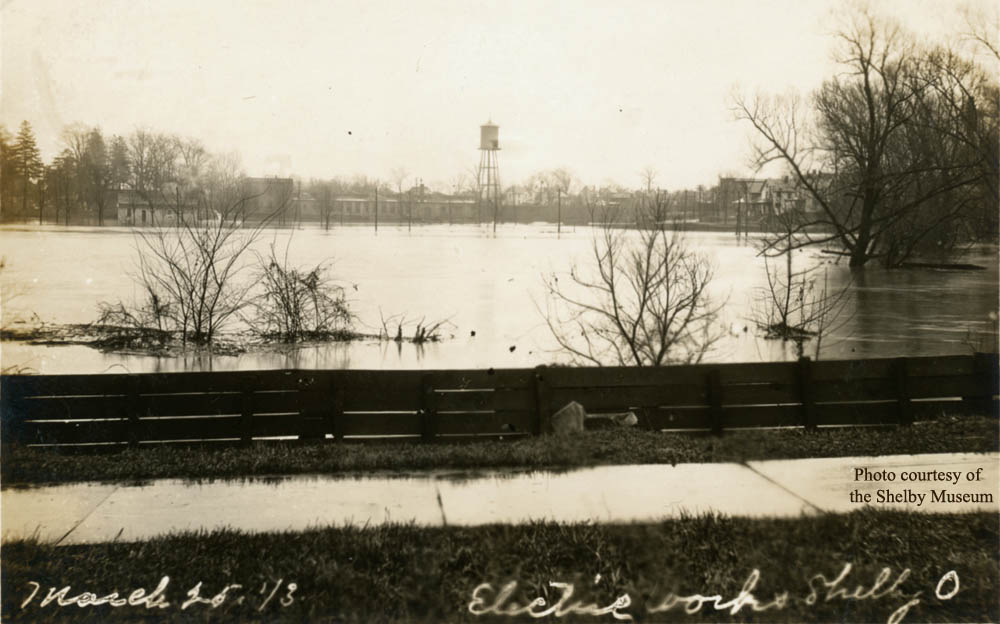 |
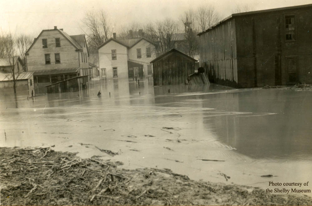
| In 1913 the Blackfork River closely approached South Gamble Street between the Abbott Farm Implement Store (37 South Gamble) and Roscoe Crall's home at 47 South Gamble. This picture was taken somewhere between the two, facing east. Note the water tower for the Shelby Printing Company. Also note the absence of what was to be the new high school (built in 1925) and the athletic field which was constructed during 1929 - 1930. As a result, the homes at the junction of Mack and Park Avenues are easily visible at the right. |
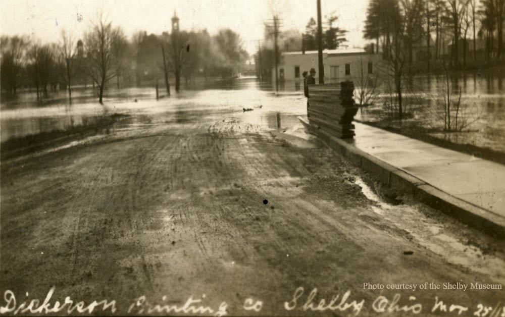 |
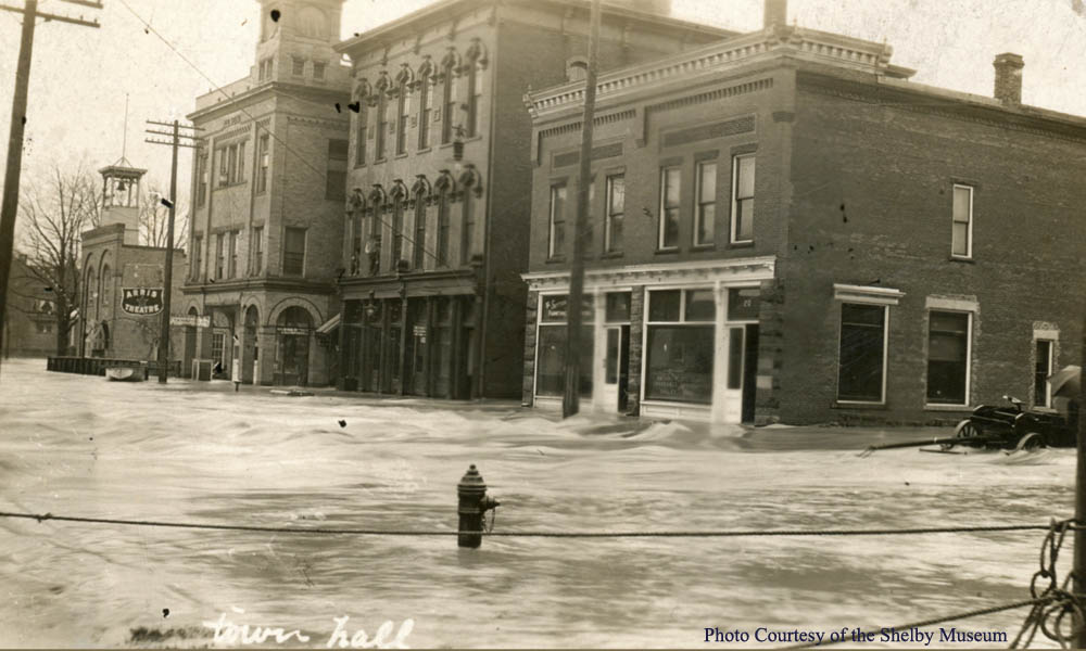
| Now the photographer has moved to the junction of Mack and Park Avenues and this photo was taken looking south down High School Avenue. The white building is Dickerson Printing at 40 High School Avenue and the Shelby Printing Company buildings are out of view, off to the right of the picture at 42 High School Avenue. Note the belltower of the 1875 Central School in the distance on the left of High School Avenue and further left can be seen the tower and silhouette of the Town Hall building on Main Street. |
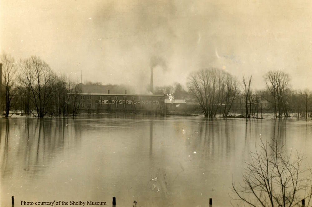 |
| This is a photo taken looking to the east from the Big Four R.R. tracks just south of where they intersect Smiley Avenue. The Blackfork appears to have covered all the property between the tracks and The Shelby Spring Hinge and beyond to the B.&O. R.R. tracks. |
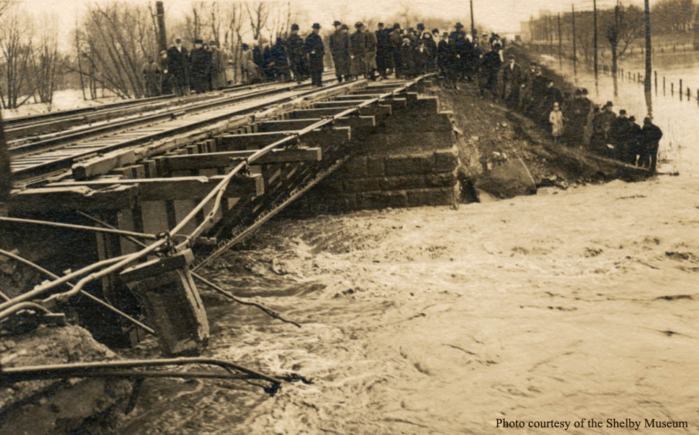 |
| The Big Four R.R. intersects the Blackfork River on the north side of Shelby, between the Smiley Avenue and North Broadway crossings, via this bridge. The view is looking northeast toward the North Broadway crossing. The flooded river has done significant damage to both the bridge and abutments. |
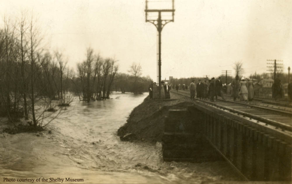 |
| This is another photo of the Big Four bridge crossing the Blackfork River north of Shelby. The river is exiting on the north side of the bridge in this view. |
 |
 |
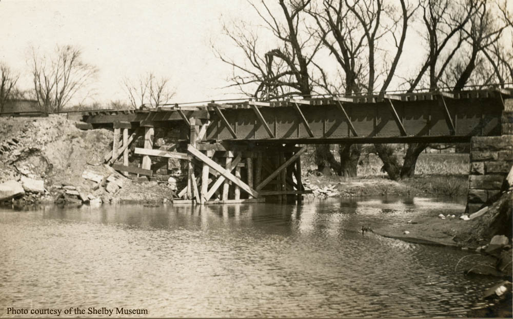 |
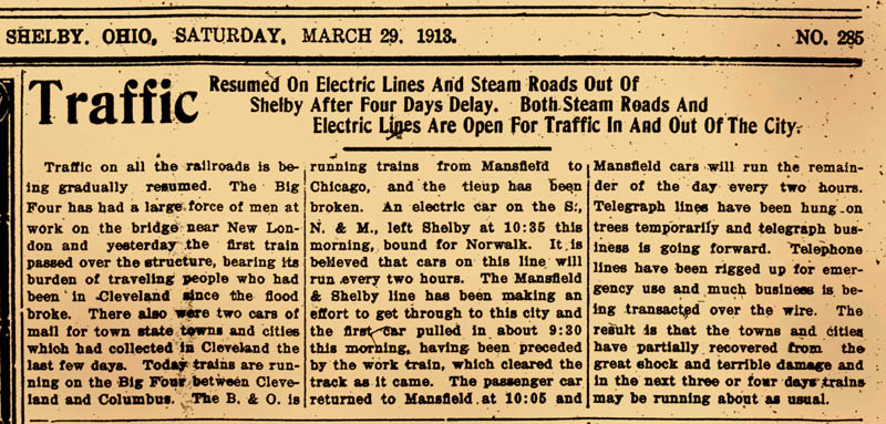
| The Big Four bridge showing the damage incurred during the flood. It underwent temporary repairs to reestablish use of the railroad through Shelby. By March 29, 1913 trains were again running on all the rail lines passing through Shelby. |
 |
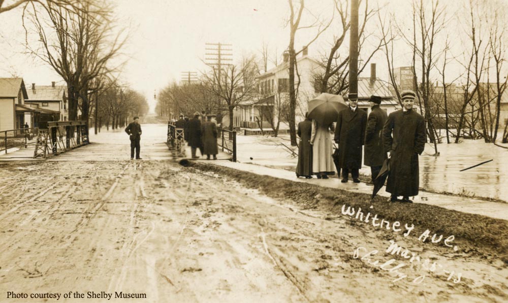 |
| Onlookers at the Whitney Avenue bridge are surveying the Blackfork after it has receded from it's peak levels. This view is looking east across the bridge toward the B.&O. R.R. grade in the distance. |
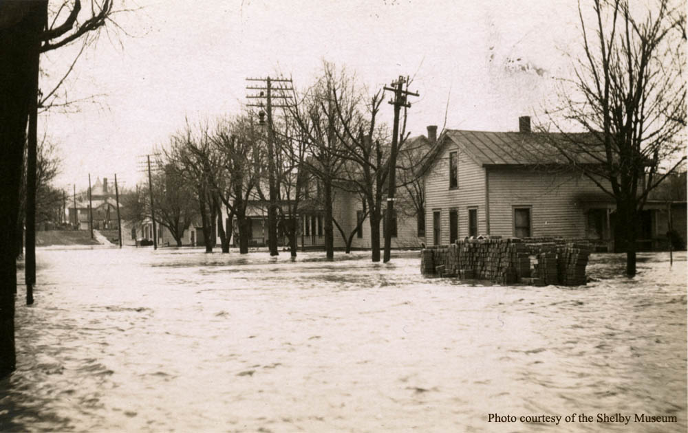 |
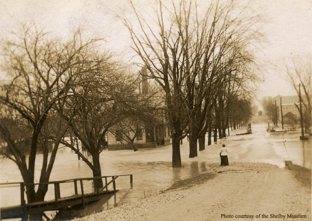
| Another view of Whitney Avenue, with the river at a much higher level. The grade in the distance is the B.&O. R.R. with the roof and bell tower of Grant School barely visible beyond it. |
 |
| A final view of Whitney Avenue, with the river at receded level. In the distance across the bridge is the slope up to North Gamble Street. On the right beyond the bridge can be seen the buildings (11 - 15 West Whitney) of The Shelby Shreffler Carriage Works with Samuel Shreffler proprietor. Beyond that can be seen the silhouette of the roof at the corner of Whitney and Gamble (33 North Gamble) which is now the Barkdull Funeral Home. Don't you wonder what the wooden structure at the lower left might be? Maybe something deposited there at the height of the flood. |
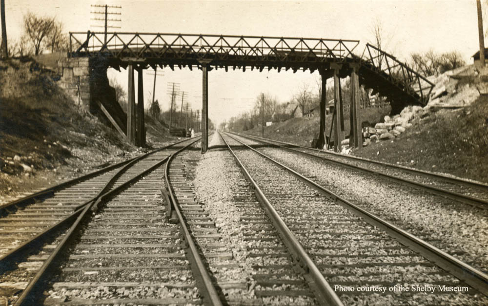 |
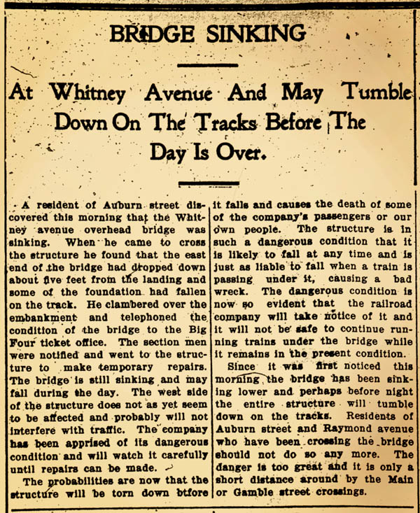
| The Whitney Avenue trestle bridge abutments were badly damaged due to run off from the large amount of rain that fell during the flood. It was reported that nearly 10 inches of rain fell in less than forty eight hours. The reports also indicated it was the east end of the trestle bridge that sustained the most damage, therefore the view must be looking north down the Big Four tracks. |
 |


Copyright © 2003 - 2025